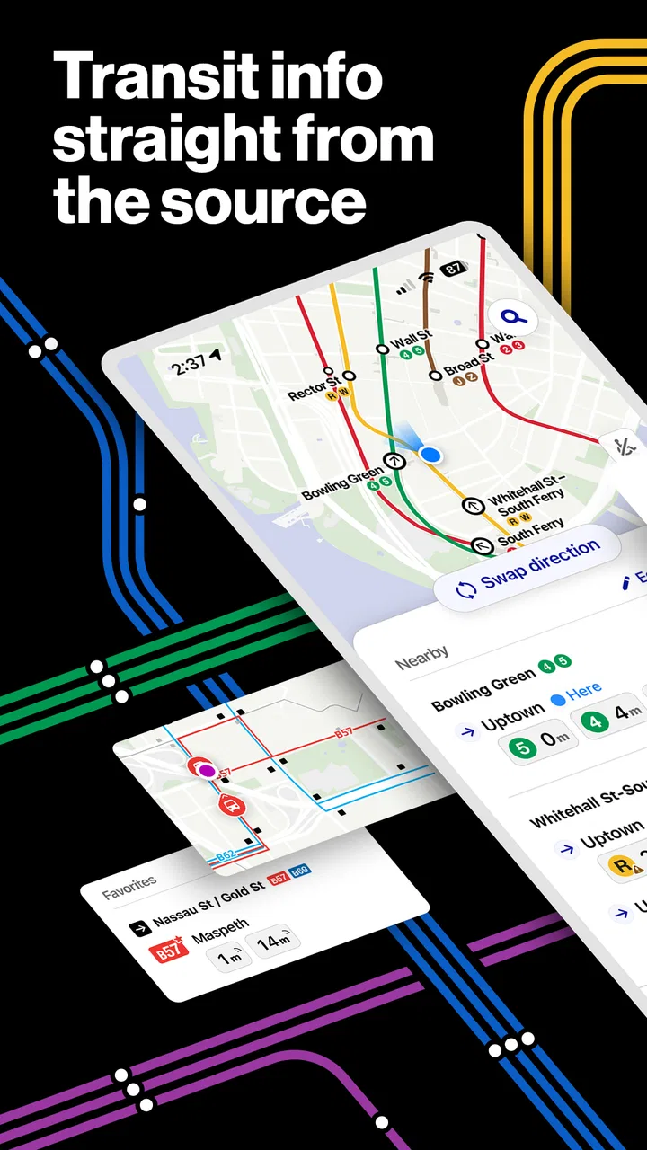
The Official MTA App
- 3.1
- Rating
- 1.00M
- Installs
- Free
- Price

 Analysis by App-foxy
Getting around New York is rarely difficult because there is only one route. The real challenge is choosing between subway service, buses, Long Island Rail Road, and Metro-North while conditions change around you. The Official MTA App brings those services into one travel tool, and after using it as my main reference, I found its biggest strength to be practical rather than flashy: it gives me one place to check the network I am actually considering instead of making me jump between separate transit resources.
That focus makes it a useful Travel & Local app for regular riders, visitors, and anyone who needs a quick answer before leaving home. It is free, rated for Everyone, and developed by MTA, so its purpose is clear from the start. I would not call it a complete replacement for every navigation app, but I do think it is the better first stop when the journey involves MTA services directly.
Why the official MTA approach works well
The most convincing part of the app is its breadth. Subway and bus riders can use it, but the same installation also covers LIRR and Metro-North. That matters when a trip crosses the usual boundaries of New York travel. A person heading from Manhattan toward Long Island, or from the city toward the Hudson Valley, does not need to treat commuter rail as a separate planning problem.
You May Also Like

 Blood Strike: 2.5 Anniversary
Blood Strike’s Loadouts Turn Every Drop Into a Tactical Gamble
A close look at Blood Strike’s custom loadouts: how fast access to signature weapons reshapes its battle royale rhythm, rewards preparation, and narrows the gap between fights.

 Pandora - Music & Podcasts
Pandora’s Music Is Easy to Start, but Harder to Recover
Pandora’s strength is its low-effort path from a seed to a station. Its weak spot is how much confidence it asks you to place in connection, setup, and quiet recovery.

 8 Ball Pool
 Is Built on Rivalries, Rematches, and Routine
A close look at the rivalries, rematches, shared routines, and unanswered safety questions that turn a quick pool match into a persistent mobile community.

 Samsung Music
’s Quiet Strength Is Playing What You Already Own
Its reach comes less from spectacle than from dependable access to a personal library. That simplicity is both the app’s strongest retention engine and its ceiling.

 AccuWeather: Weather Radar
AccuWeather Review: A Quick, Clear Forecast for Everyday Decisions
For everyday plans, the best forecast is the one you can understand quickly. AccuWeather makes rain timing, radar, and local conditions easy to act on, with a few trade-offs.

 Hill Climb Racing
Why Hill Climb Racing Still Turns Crashes Into One More Run
A tiny car, a bumpy hill and one more upgrade: Hill Climb Racing keeps resurfacing because its simple chaos makes every near-miss feel personal.
More From Our News Desk



I also appreciate the difference between an official transit app and a general map application. A map app is often excellent at suggesting a route from one address to another, especially when walking directions and several transport operators are involved. The MTA app has a narrower responsibility, and that can be an advantage. When I want to understand the status of an MTA line or compare the agency’s own services, I prefer going straight to the source rather than filtering a broad collection of travel results.
The app’s store summary promises subway, bus, LIRR, Metro-North, and more in one place. In everyday use, that combination changes how I prepare for a trip. I can check the rail option before leaving, then keep the same app available when I reach the city and need to continue by subway or bus. That continuity is more useful than it sounds, particularly for visitors who may not know which part of the network handles each leg.
A realistic morning trip
Imagine I am staying outside Manhattan and need to reach an appointment downtown. I can begin by checking Metro-North or LIRR, depending on the direction of travel, then use the subway or bus information after arriving. If I used separate tools, I would have to remember which one handles each segment and repeat the search whenever plans change. With this app, the planning process feels more unified.
The same workflow helps when I am meeting somebody at a station rather than traveling to a precise address. I can look at the relevant rail service first, then check the city connection separately without abandoning the MTA ecosystem. It is not about saving a dramatic amount of time on every search; it is about reducing small points of confusion during a trip that already has enough moving parts.
Another useful habit is checking the app before walking to a station, not only after I have entered the system. That gives me a chance to reconsider the route while I still have alternatives. If the best-looking rail option is inconvenient, I can compare it with subway or bus travel before committing to a long walk. This is one of the app’s less obvious strengths: it supports decisions before the journey, not just navigation once the journey has started.
Where the official source has an edge
For MTA-specific travel, the official origin gives the app credibility and focus. I do not have to wonder whether a third-party route summary has simplified a service change or placed an MTA line beside unrelated transport information. The app is built around the network that New York riders actually use, which makes it easier to interpret when I am already familiar with the system.
That does not mean every traveler should abandon Google Maps, Apple Maps, or another favorite planner. Those alternatives can be more convenient when I need door-to-door walking instructions, restaurant stops, cycling choices, or a broad comparison involving other operators. My preferred setup is often to use the MTA app for the transit decision and a general map app for the final walk. Each tool is doing the job it handles best.
For someone new to New York, the official app also reduces the risk of treating the subway as the entire network. A trip that looks like a subway question may actually be easier by bus or commuter rail. Having those services presented together encourages a wider comparison, especially when the destination is outside the central city or when a transfer would make the subway route awkward.
Small workflows that make it more useful
I recommend checking the complete journey in stages rather than entering the destination once and accepting the first suggestion. First, identify the main service that gets you closest to the area. Then inspect the connecting MTA option. Finally, allow time for the walk between the station and the actual destination. This approach is particularly helpful when a rail trip ends far from the final appointment.
I also use the app as a decision tool when plans are flexible. If I am choosing between an express-looking subway route and a bus route with fewer stairs, I do not judge only by the headline travel time. I consider the walk to the stop, the number of transfers, and whether I would rather remain above ground. The app is most valuable when I use its network coverage to compare realistic alternatives rather than treating it as a command to follow blindly.
A third tip is to check the service relevant to the return journey before starting the outbound trip. This is easy to overlook, especially when leaving for an appointment in an unfamiliar neighborhood. Knowing whether the return depends on a different rail service or a less convenient connection can change where I choose to spend time during the day. The app helps me think about the trip as a round journey instead of two unrelated searches.
For visitors, I would save the app on the home screen and open it before leaving the hotel or rental. That simple routine is better than waiting until a platform feels crowded and then trying to make a complicated decision. For locals, the benefit is less about learning the system and more about having subway, bus, LIRR, and Metro-North information close together when an ordinary commute changes unexpectedly.
What may frustrate experienced travelers
The app’s focused scope is also its main limitation. It is designed around MTA services, not around every part of a complete city itinerary. If I need detailed pedestrian navigation, a precise street-level arrival point, or a comparison with transport outside the MTA network, I may still need another app. That extra step can feel inconvenient when I am already carrying luggage or rushing to an appointment.
I also would not rely on any transit app as my only plan when timing is critical. Route information can help me make a sensible choice, but real trips still involve crowded platforms, slow boarding, missed connections, and changing conditions. I leave a margin rather than assuming that the neatest route on screen will unfold perfectly. The MTA app improves preparation; it does not remove the uncertainty of traveling through a busy metropolitan system.
Another trade-off is that the app makes the most sense to people who already understand at least a little about New York’s geography. A first-time visitor may see the service names and still wonder which one is appropriate for a particular neighborhood. The unified coverage is valuable, but it does not automatically teach every newcomer how the network fits together. I would pair it with a map during the first few trips, then rely on it more as my familiarity grows.
There is also a difference between checking information and making a final judgment. I may find that two options appear reasonable, but one involves a transfer that is uncomfortable with luggage, while the other requires a longer outdoor walk in poor weather. The app can support that choice, yet I still need to apply common sense. This is not a criticism of the product so much as an important boundary: official information is not the same as personal travel advice.
On the technical side, I would keep my phone charged before a long day and avoid treating the app as a substitute for basic preparation. A dead phone can turn a convenient digital reference into no reference at all. I like having a rough idea of my destination and the main service before I set out, especially when I am traveling somewhere unfamiliar. The app works best as a dependable aid within that preparation, not as the sole thing holding the trip together.
Who should install it?
I think the best audience is anyone who regularly uses more than one MTA service. A commuter who combines LIRR with the subway, a traveler moving between Metro-North and a city bus, or a local who changes between subway and bus during the week will get more value than somebody who takes one familiar route every day. The app’s central advantage is the shared view of the network.
It is also a strong choice for visitors who want an official starting point without paying for another travel tool. Since it is free and rated for Everyone, there is little barrier to trying it before a New York trip. I would especially recommend it to travelers whose plans include destinations beyond the subway’s most familiar areas. The presence of commuter rail and buses makes it more relevant to a wider part of the region than a subway-only reference.
People who should skip it as their primary planner are those who need a single app to manage every transport mode and every walking detail. If my priorities are restaurant stops, turn-by-turn directions, cycling, ride-hailing, or a broad comparison of unrelated operators, I would begin with a general map service instead. I might still keep the MTA app nearby for official network checks, but it would not be my only travel companion.
The app has attracted a substantial audience, with more than a million installs, around a four-and-a-half average rating, and roughly seven thousand ratings. Those figures suggest that it has become a familiar option rather than a niche experiment. I would interpret that positively, while still remembering that popularity does not make it perfect for every travel style.
Version, access, and everyday practicality
The current version is 3.24.2, and the app supports devices running Android 8.0 or later. That makes it accessible to many Android users, although anyone carrying an older phone should check compatibility before planning around it. The app is free, which is important for visitors who do not want to pay simply to obtain transit information for a short stay.
Its age rating is Everyone, so I see it as suitable for ordinary household use, including families planning trips together. The developer is MTA, the Metropolitan Transportation Authority, which reinforces the app’s role as a direct companion to the services it covers. That official identity is the reason I would open it when I want MTA-focused information, even if another app remains better for walking directions.
One practical question many travelers have is whether the app is useful only for daily commuters. In my view, no. A visitor can benefit from it precisely because the network is unfamiliar. The key is to use it alongside a street map at first: let the MTA app help choose the service, then use the map to understand the walk and the surrounding blocks.
Another likely question is whether it replaces separate tools for LIRR or Metro-North. For basic planning across those services and the city network, its all-in-one design makes separate MTA-focused installations less necessary. I still would not expect one app to answer every question about a complete regional itinerary, but having these services together is a meaningful convenience.
My answer to the reliability question is similarly balanced. I trust the app as the first place to check MTA travel, but I still plan conservatively. If I have a medical appointment, a flight, an interview, or a timed reservation, I check early and leave extra room. The app can help me choose intelligently; it cannot guarantee that a real-world trip will be smooth.
My final recommendation
After using it as a practical travel reference, I see The Official MTA App as a focused and worthwhile tool rather than a universal navigation solution. Its strongest quality is the way it gathers subway, bus, LIRR, and Metro-North travel into one MTA-centered experience. That makes route planning less fragmented and gives both locals and visitors a clearer starting point.
I especially recommend it to riders who cross between city transit and commuter rail, or to anyone who wants to check MTA options before relying on a broader map app. I would not choose it alone for detailed door-to-door navigation, but that is a reasonable limitation for an app with a clearly defined purpose. Used together with a general map when necessary, it becomes more useful than either tool would be on its own.
My honest verdict is simple: install it if MTA services are part of your regular life or your upcoming New York trip. Use it to compare the network, prepare both directions of your journey, and check the main service before walking to a station. The real strength is not just having more transit modes in one app; it is having a clearer way to make the right MTA choice before a small travel problem becomes a stressful one.
FAQs for The Official MTA App
01What features does the Official MTA App offer?
The Official MTA App provides real-time updates on train and bus schedules, service changes, and delays. It also offers a trip planner, route maps, and the ability to purchase tickets directly through the app. Additionally, users can receive personalized alerts for their favorite routes and stations.
02Is the Official MTA App available for both Android and iOS?
Yes, the Official MTA App is available for download on both Android and iOS platforms. Users can find it on the Google Play Store for Android devices and the Apple App Store for iOS devices. The app is designed to work seamlessly across different operating systems.
03Is there a cost associated with using the app?
The Official MTA App is free to download and use. However, while the app itself does not require payment, purchasing tickets or passes through the app will require payment. Users must have a valid payment method linked to their account to make purchases.
04How reliable is the real-time information provided by the app?
The app sources its data directly from the MTA's official systems, ensuring a high level of reliability and accuracy for real-time information on schedules and service changes. However, occasional discrepancies may occur due to unforeseen circumstances like technical issues or sudden service disruptions.
05Can I use the app offline?
Some features of the Official MTA App, such as downloaded route maps, can be accessed offline. However, real-time updates and trip planning require an internet connection to provide the most current information. It's recommended to have data access to fully utilize the app's capabilities.
Pros
- Real-time bus and train updates.
- User-friendly interface with clear maps.
- Includes fare information and alerts.
- Supports multiple payment options.
- Offline access to saved routes.
Cons
- Occasional app crashes reported.
- Limited customization for alerts.
- High battery usage when active.
- Requires constant internet for updates.
- No dark mode available.

The Official MTA App
Gallery